 English
 العربية
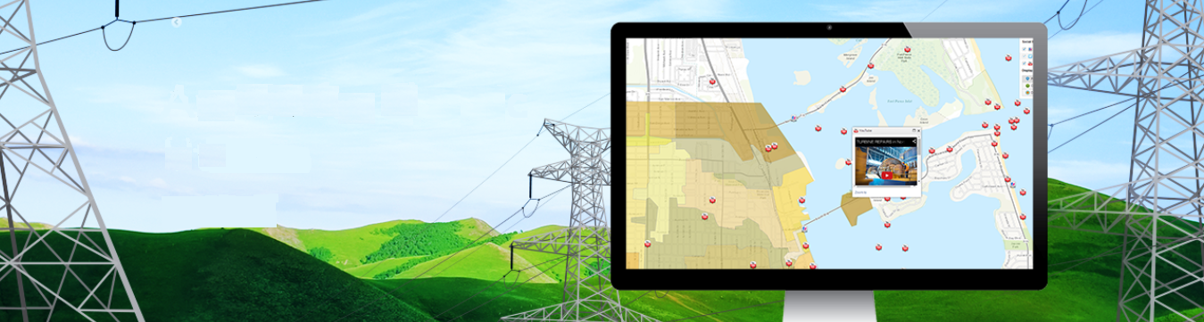
GIS Mapping
We use GIS cutting edge technologies to provide valued planning Information to decision makers on BIM, Land use, Transportation, Electric, Gas and Water utilities, Hydrology and other Site suitability analysis etc. GMAP LLC utilizes the analytic power of GIS in various spatial analysis and modelling work.
Our core service areas includes,
BIM is an intelligent model-based process that provides insight to help you plan, design, construct & manage buildings and infrastructure. Our BIM mapping is a combined process of Lidar and GIS technology.
- Which reduces the need for manual checking of 2D drawings.
- Effectively communicates design errors and omission issues.
- Automated Quantity take offs.
- Facility management.
We provide industries best standard Electric distribution Network map and their service territory. Construction and maintenance require these maps as the source of information for maintenance planning and location information. These maps help you leverage your geographic information to manage outages, maintain safety and compliance, cut costs and improve customer satisfaction.
We map the Service areas and demographic details for various service territories.
We produce GIS Enabled Enterprise Asset Management system data model and data maintenance solution based on an asset id in our spatial database, which covers full Geodatabase model of existing features.
We provide our client to spatially manage their capital infrastructure assets to minimize the total cost of owning, operating and maintaining assets at acceptable levels of service. We provide high precision mobile mapping solutions allowing pipeline operators to build or enhance accurate GIS data.
We provide our client consistent and spatially accurate representation of Gas, Oil, Water and sewer utility network data in GIS format. Enabling these utilities to improve efficiency and make smarter decisions. GMAP LLC harnesses utility data translating it into actionable insights and transforming the way Gas & Oil / Water networks operate.
We understand the challenges of pipeline utility companies and work with them to map, model, manage and maintain their distributed facilities and networks optimally under a single GIS enabled database to meet new customer expectations and industry compliance regulations.
Our mission is to provide the world-wide geospatial community with advanced and cost-effective digital photogrammetry solutions and services for creation of wide range of output products from the available remote sensing data. Our advanced GIS experts do Automatic and Manual Aerial triangulation, Stereo Compilation and Ortho photo generation. Also we prepare high resolution DEM and DTM models for specialized applications such as volumetric calculations and 3D modelling. We do automated post-processing of the UAV flight data for DTM and True ortho Photo Production.
We do Parcel mapping to display the land, property & ownership of land which helps in property assessment for special cases. Manage an accurate inventory of real property, analyze the value of land and associated improvements, describe who owns the land, and convey land-use and zoning regulations.
Deliverables
- Geodatabase
- Geospatial Shapefiles (Multiple vector formats)
- Network Dataset
- DEM, DTM, 3D Model, CAD, LAS
- Online web Services, WFS & WMS
- 3D Geospatial pdf, Kml
- Metadata
- Enterprise Geodatabase
- Map Package
- Imageries (Multiple Raster formats)
- Export to Multiple data format


